

Seabed 2030 call to action
Citizen scientists and corporate partners are being called on to help map the ocean floor by 2030.
Photography by Nippon Foundation-GEBCO
09 June 2022

Advertisement
Seabed 2030 is a collaborative project between the Nippon Foundation and GEBCO. It aims to bring together all available bathymetric data to produce the definitive map of the world ocean floor by 2030 and make it globally available.
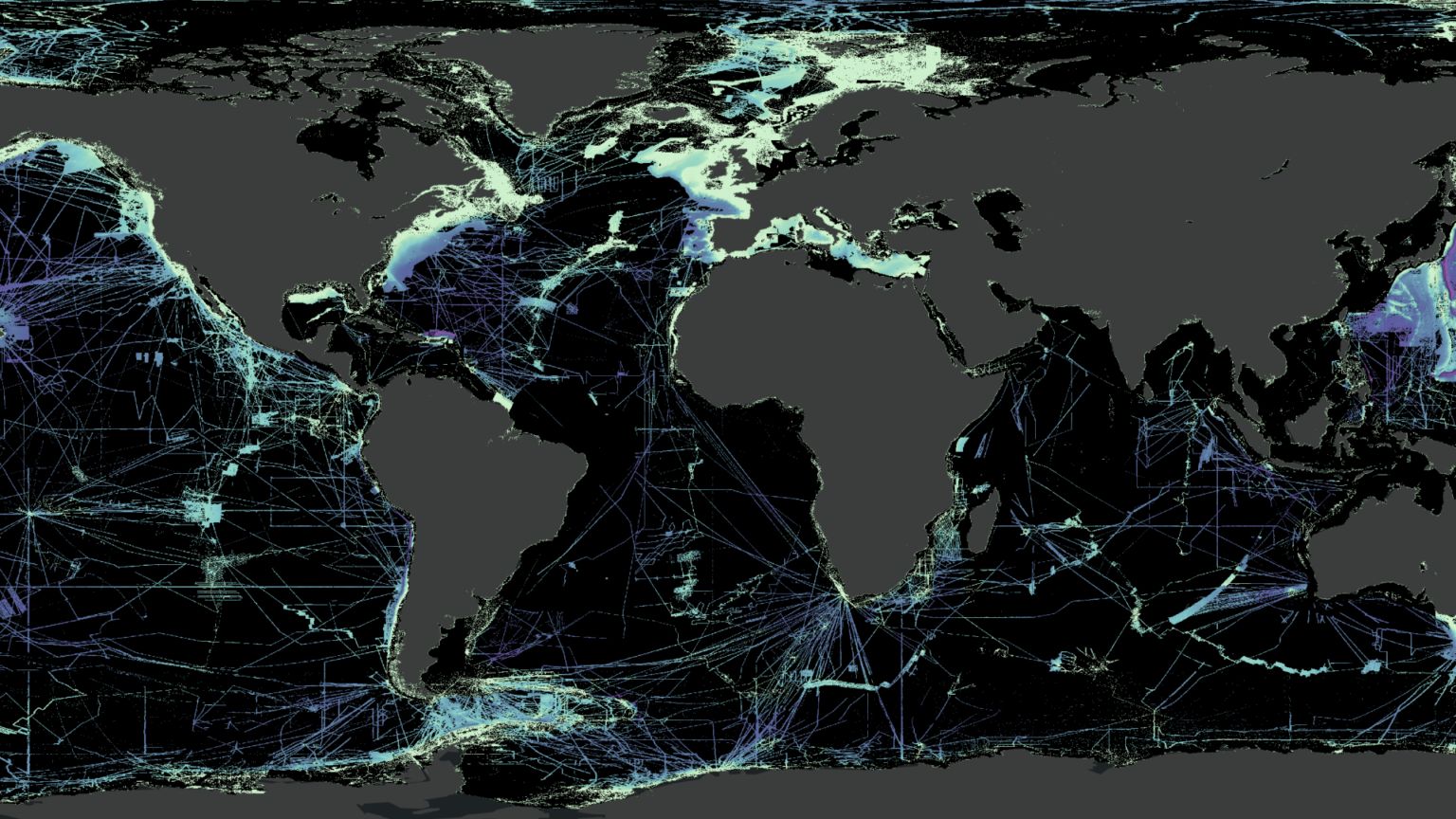
The Nippon Foundation-GEBCO Seabed 2030 project was established to map the entire ocean floor by 2030. Scientific consensus holds that less than 20 percent of the world’s ocean floor has been mapped. In fact, more is known about the topography of the Moon and Mars than that of our own planet.
The Seabed 2030 project is the product of the vision of Yohei Sasakawa, Chairman of The Nippon Foundation, who officially launched Seabed 2030 at the United Nations Ocean Conference in 2017.
Seabed 2030 supports the UN’s Sustainable Development Goal 14: “to conserve and sustainably use the oceans, seas and marine resources for sustainable development.”
To date, The Nippon Foundation-GEBCO Seabed 2030 Project has drawn on the experience of some 40 international organisations and networks spread across more than 50 countries.

Advertisement
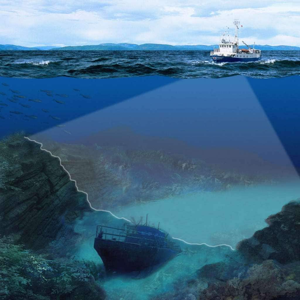
The BathyGlobe tool at the Center for Coastal and Ocean Mapping’s (CCOM) website shows those areas of the ocean that have been accurately mapped using the technology of multibeam echo-sounders.
Lack of data causes problems, for instance when a recovery team searching for Malaysian Airlines Flight MH370 had to first spend months mapping a search area in the Indian Ocean, which was insufficiently mapped.
For significant portions of the ocean, the only data available was recorded more than 100 years ago – by dropping a weight tied to a line over the edge of a boat and measuring the length to the bottom.
The shape of the seabed is critical to understanding ocean circulation patterns which affect climate and weather patterns, tides, wave action, sediment transport, tsunami wave propagation and underwater geo-hazards.
More recently, our oceans have become vitally important for wave energy conversion, which uses the rising motion of waves to generate electrical energy.
Seabed mapping is vital for the security, safety and economic health of nation states. The Blue Economy, according to the Organization for Economic Cooperation and Development (OECD), is valued at $1.5 trillion a year and creates the equivalent of 31 million full-time jobs.
More importantly, given that three billion people rely on fish as a source of protein, a deeper understanding of the sea floor will strengthen the understanding of marine ecosystems and marine life for the benefit of our current and future food supply.
There are currently over 1.1 million kilometres (approximately 424,712 square miles) of submarine cables. Google has invested billions of dollars in the routing of cables, a key infrastructure task that is highly dependent on detailed knowledge of bathymetry.
Seabed 2030 is relying on co-operation and collaboration from global partners.
Australian adventurer and environmental activist, Lisa Blair recorded valuable data on the Southern Ocean during her record-making voyage circumnavigating Antarctica, from February to May 2022 over 92 days.
As the group states: “The time has come for all of us – international organisations, universities, non-governmental organisations, maritime industries (fishing boats, survey companies, shipping lines, oil and gas companies, cruise operators, submarine cable companies), youth organisations and citizens – to support Seabed 2030 by either consolidating pre-existing data, providing data that are currently not in the public domain, planning cruises to previously unmapped regions or by helping us get the message out for building a strong global community.”
The methods being used to determine the coverage, and progress to date, can be found here.
-

Advertisement
-

Advertisement
-

Advertisement